After the worst flooding many residents could remember struck Northern Michigan, a reporting team led by Tammy Webber set out to answer two critical questions: Why were so many people caught by surprise, and what does it mean for communities across the country?
The multiformat package by Webber, data reporter M.K. Wildeman, video journalist Julian Trejo Bax and photographer Paul Sancya uncovered significant shortcomings in how the federal government assesses and communicates flood risk. Their reporting showed that FEMA’s flood-mapping system is outdated in many areas and often fails to reflect the growing dangers posed by ever-evolving climate change.
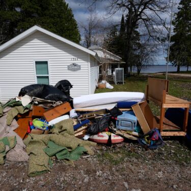
Webber began by interviewing experts, visiting devastated communities and reviewing FEMA documents to understand why residents had little warning of the risk they faced. Trejo Bax and Sancya documented the destruction around Black Lake, where floodwaters rose so high that floating ice crashed through homes, providing compelling and arrestingly intimate visual evidence of the disaster’s human toll.
The reporting revealed millions of Americans may not realize they’re vulnerable to flooding because FEMA has never mapped floodplains in many rural communities, despite a congressional mandate to do so.
The story, interactive map and video were used by dozens of news organizations in the U.S.
Judges praised the package for its powerful accountability journalism, captivating visuals and national relevance.
For rigorous reporting and meaningful public impact, Webber, Wildeman, Trejo Bax and Sancya are this week’s Best of the AP — Second Winner.

Related articles